
by WorldTribune Staff, November 20, 2016
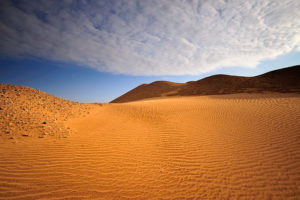
Technology developed to explore the subsurface of Mars is being used by a NASA-led team to search for water deep beneath the Kuwait desert.
“An international team led by research scientist Essam Heggy of NASA’s Jet Propulsion Laboratory, Pasadena, Calif., recently traveled to northern Kuwait to map the depth and extent of aquifers in arid environments using an airborne sounding radar prototype,” according to a report on NASA’s website.
“This research will help scientists better understand Earth’s fossil aquifer systems, the approximate number, occurrence and distribution of which remain largely unknown,” said Heggy. “With this technology, we can detect layers deposited by ancient geological processes and trace back paleoclimatic conditions that existed thousands of years ago, when many of today’s deserts were wet.”
The team, which includes personnel from the Kuwait Institute for Scientific Research (KISR), is using a 40-megahertz, low-frequency sounding radar provided by the California Institute of Technology.
A helicopter equipped with the radar recently completed 12 low-altitude passes (1,000 feet, or 305 meters) over two areas known to contain freshwater aquifers. Researchers said the missions “successfully demonstrated that the radar could locate subsurface aquifers, probe variations in the depth of the water table, and identify locations where water flowed into and out of the aquifers.”
“This demonstration is a critical first step that will hopefully lead to large-scale mapping of aquifers, not only improving our ability to quantify groundwater processes, but also helping water managers drill more accurately,” said Muhammad Al-Rashed, director of KISR’s Division of Water Resources.
According to NASA, the radar is sensitive to changes in electrical characteristics of subsurface rock, sediments and water- saturated soils. Water-saturated zones are highly reflective and mirror the low-frequency radar signal. The returned radar echoes explored the thick mixture of gravel, sand and silt that covers most of Kuwait’s northern desert and lies above its water table.
The radar sounding prototype “shares similar characteristics with two instruments flying on Mars-orbiting spacecraft: Mars Advanced Radar for Subsurface and Ionospheric Sounding (MARSIS), on the European Space Agency’s Mars Express, and Shallow Radar (SHARAD), on NASA’s Mars Reconnaissance Orbiter,” NASA said.
“MARSIS, jointly developed by JPL and the Italian Space Agency, probes the Martian subsurface sediments and polar ice caps to a maximum depth of about 1.9 miles (3 kilometers). SHARAD, also built by the Italian Space Agency, looks for liquid or frozen water in the first few hundred feet of Mars’ crust and probes Mars’ polar caps. Both instruments have found evidence of ice in the Martian subsurface, but have not yet detected liquid water. The Kuwait results may lead to revised interpretations of data from these two instruments.”
NASA using Mars exploration tech in search for water in Kuwait desert added by World Tribune on
View all posts by World Tribune →